Affordable
SmartCam3D® is very affordable compared to alternative geospatial augmented reality systems. If you are interested in receiving a quote, please contact us.
Licensable
SmartCam3D® can be licensed and integrated into 3rd-party solutions. This means if you have your own application, hardware, software, Mission Management System, or other solution, SmartCam3D® can be integrated and provided as a white label capability in your product.
User-Friendly
SmartCam3D® is user-friendly. If you're looking to integrate SmartCam3D® into your product, we can provide guidance, sample apps with example UI, and more.
Sensor Agnostic
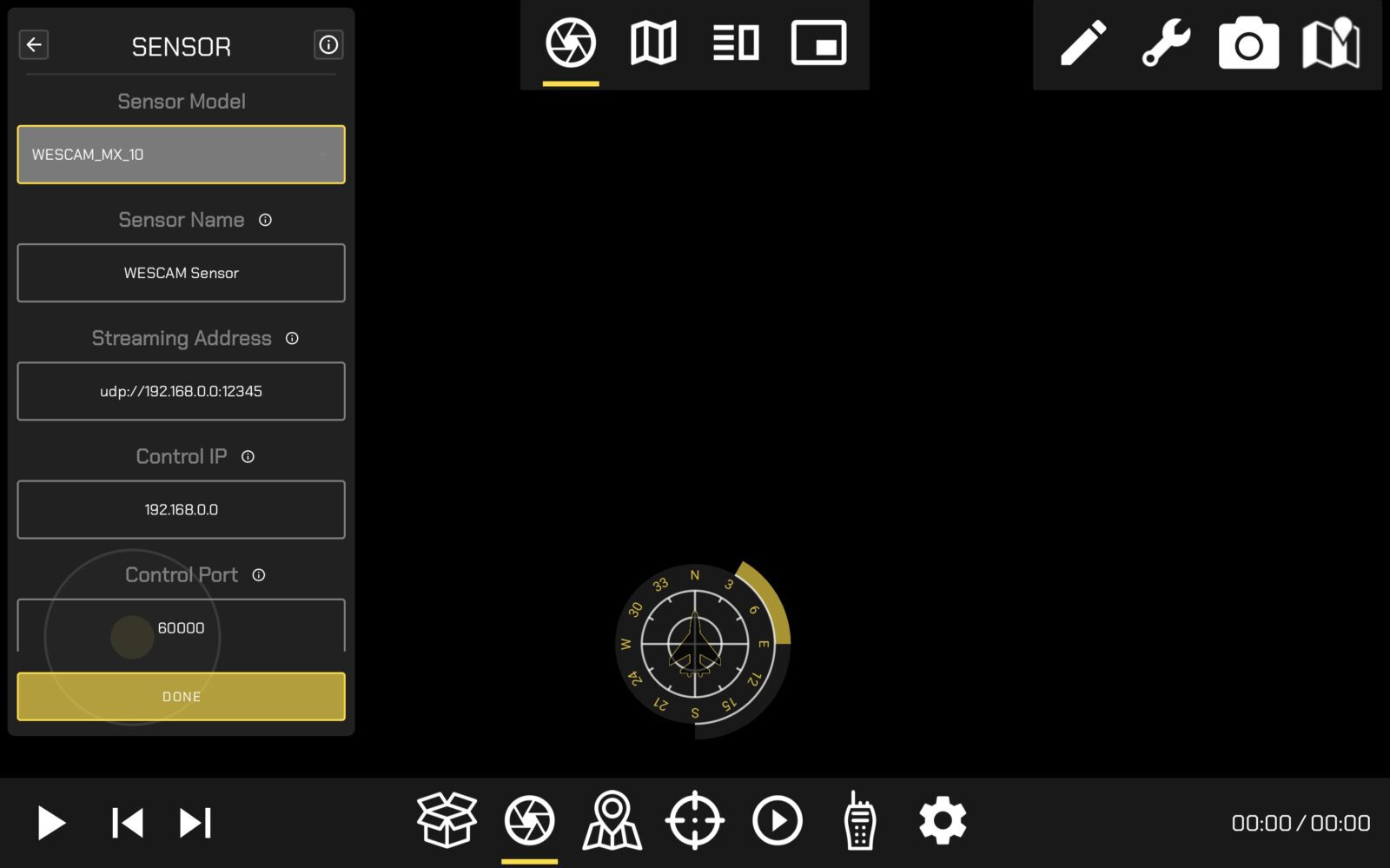
SmartCam3D® is compatible with video offering KLV metadata. Common formats include MISB 0601, STANAG 4609, and more. SmartCam3D® has been used with videos sourced from small, inexpensive UAS, up to manned aircraft with large EO/IR gimbals. Contact us for more information on compatibility.
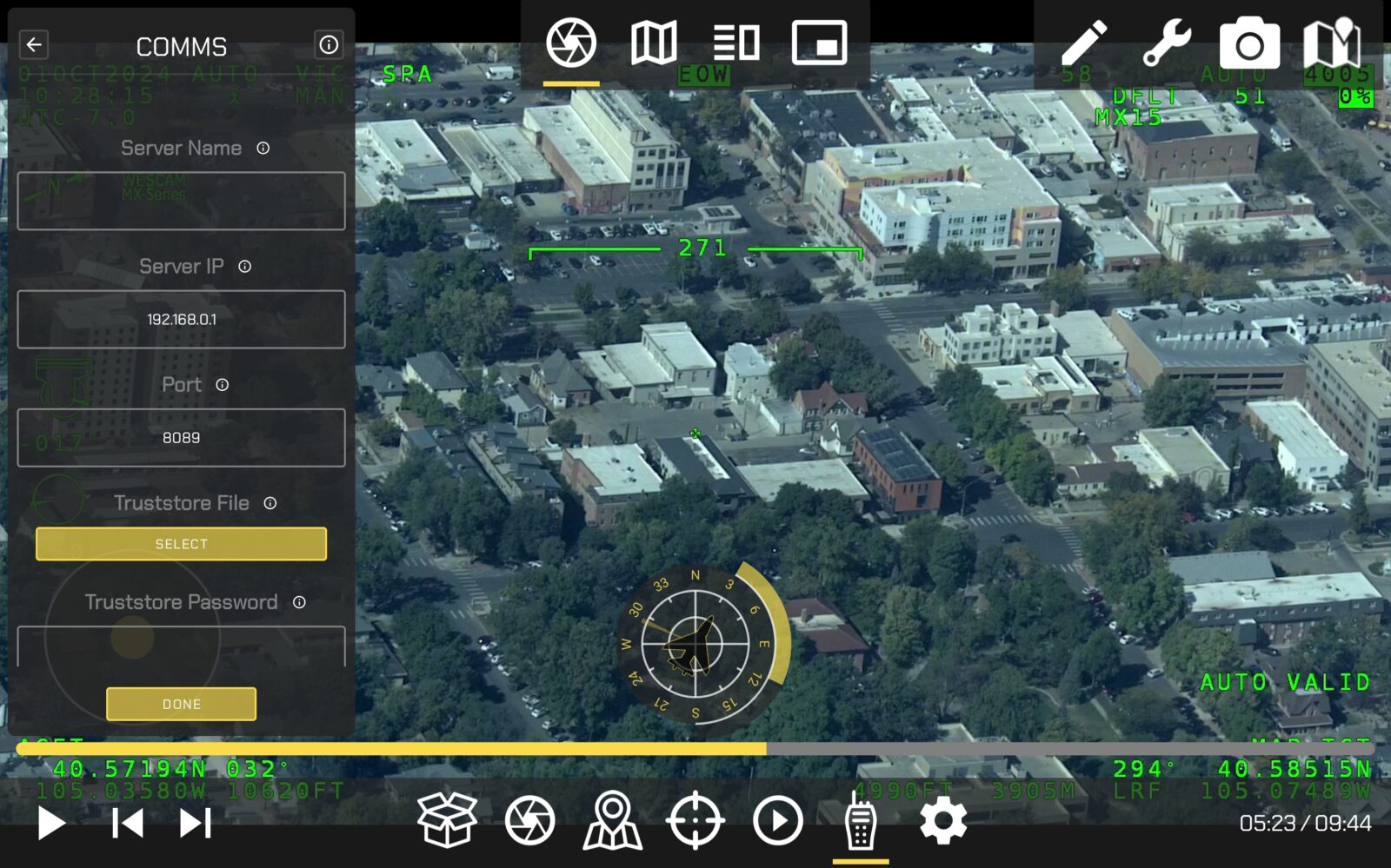
FMV Player
SmartCam3D® can be integrated into a variety of video players. The primary requirement is that accurate, timely, synchronous KLV metadata be provided to the SmartCam3D® library.
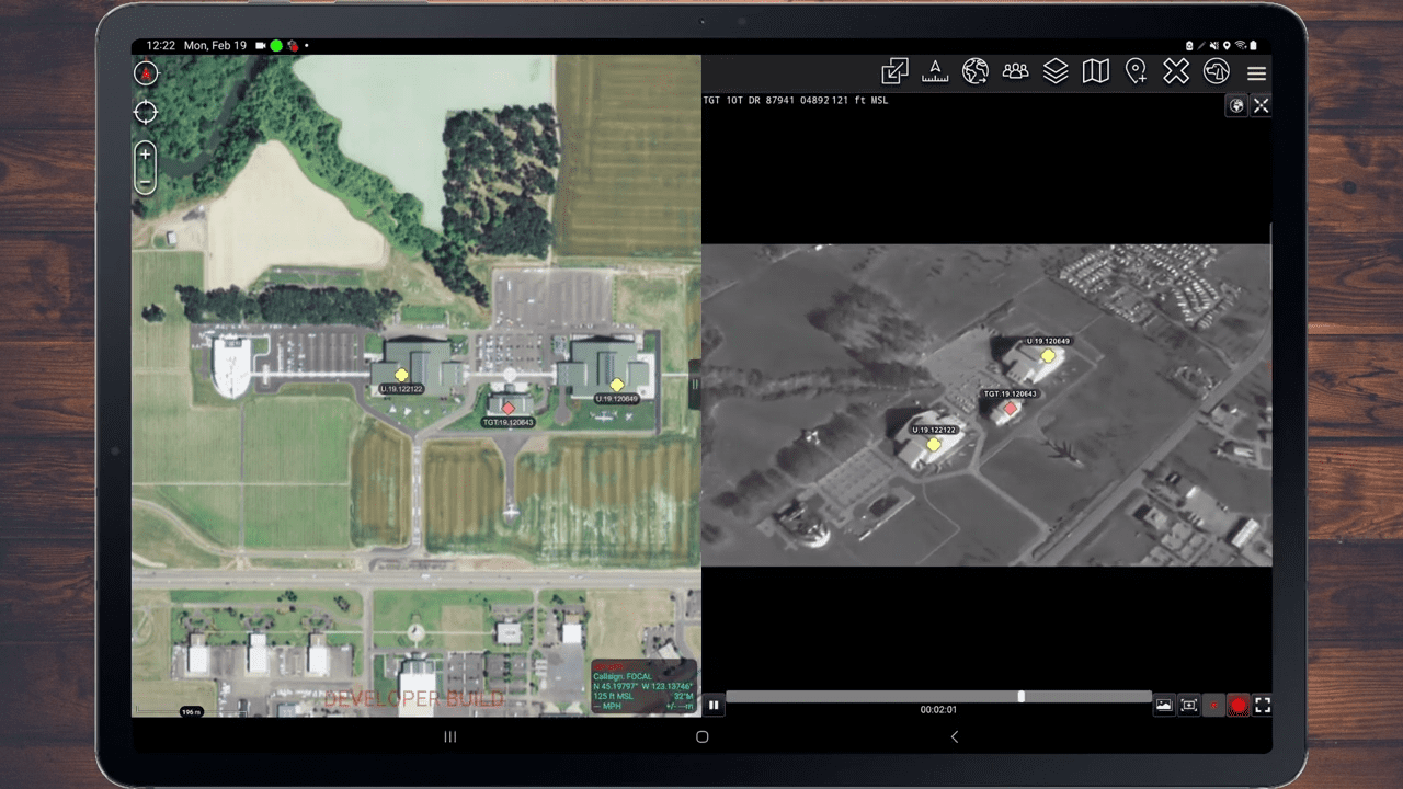
Geospatial AR
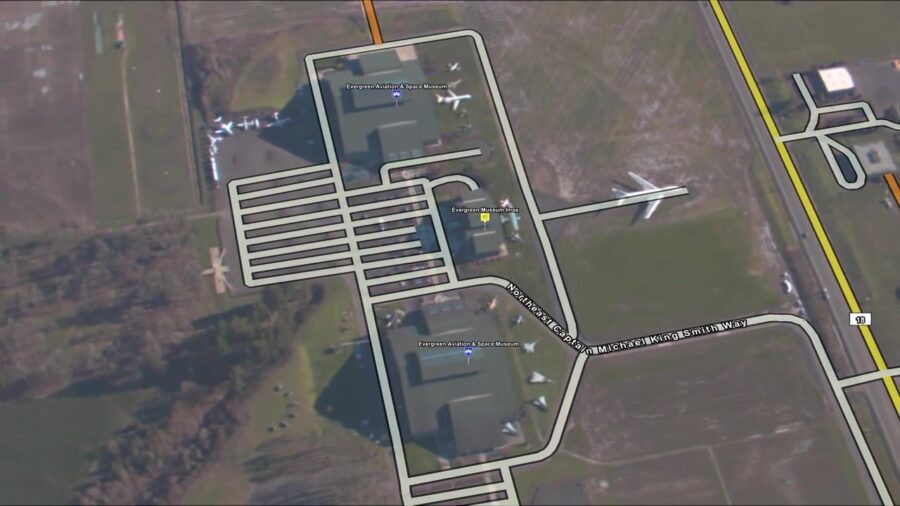
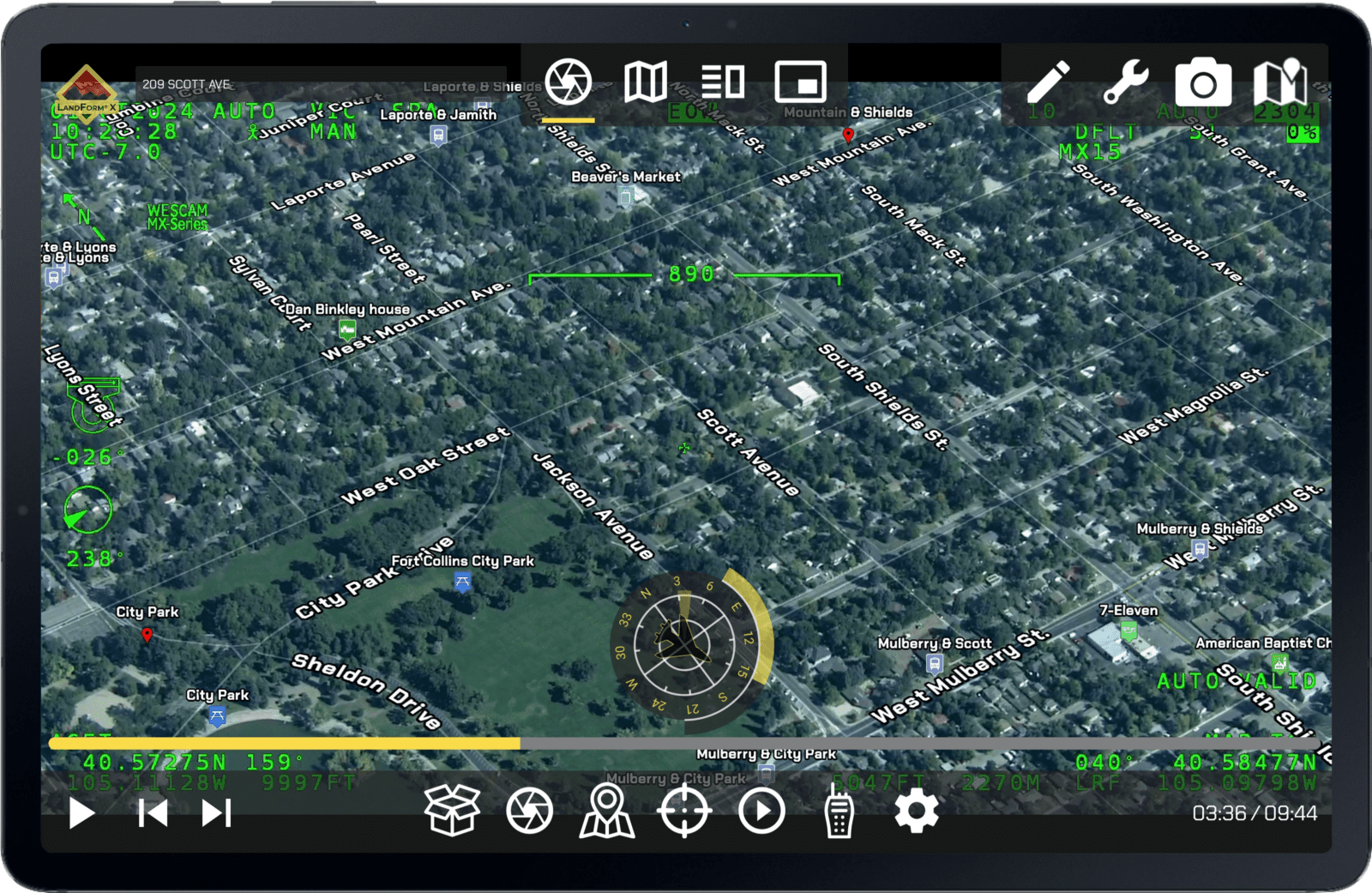
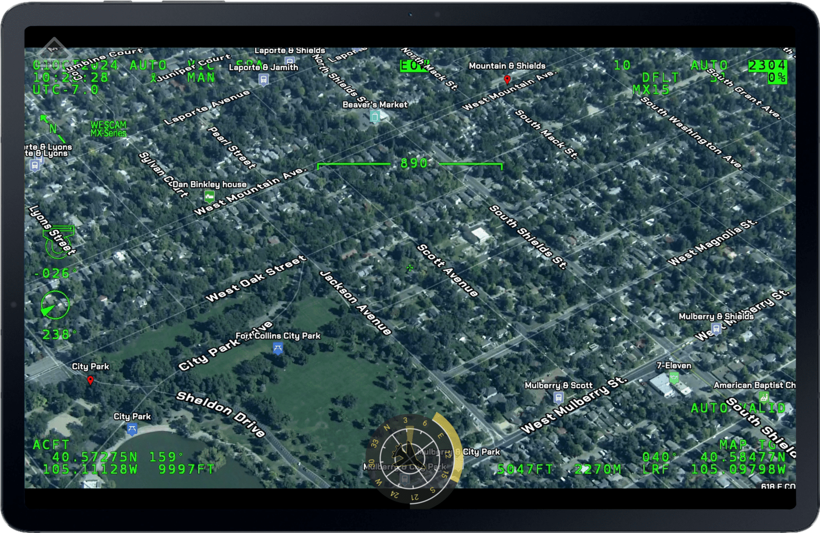
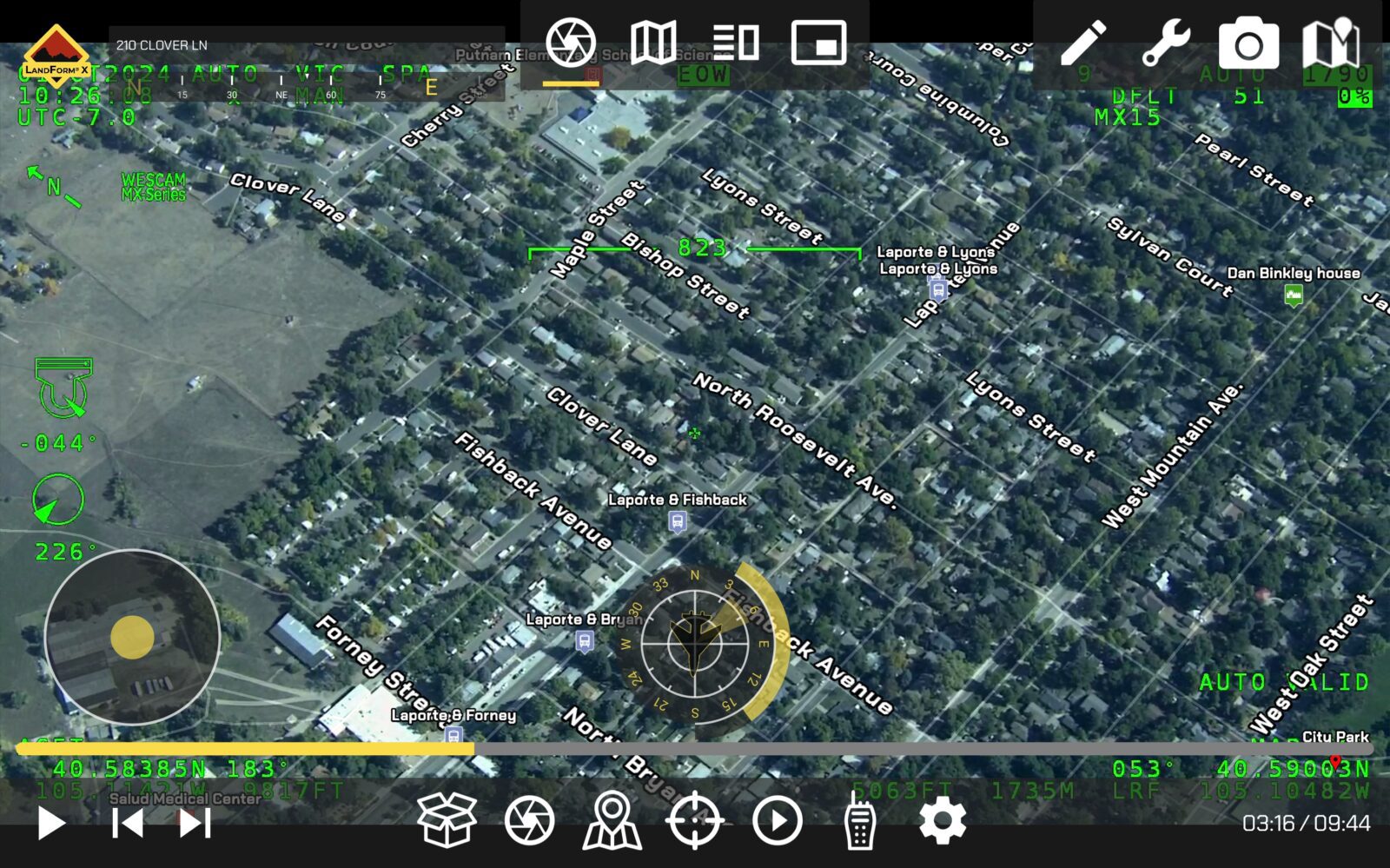
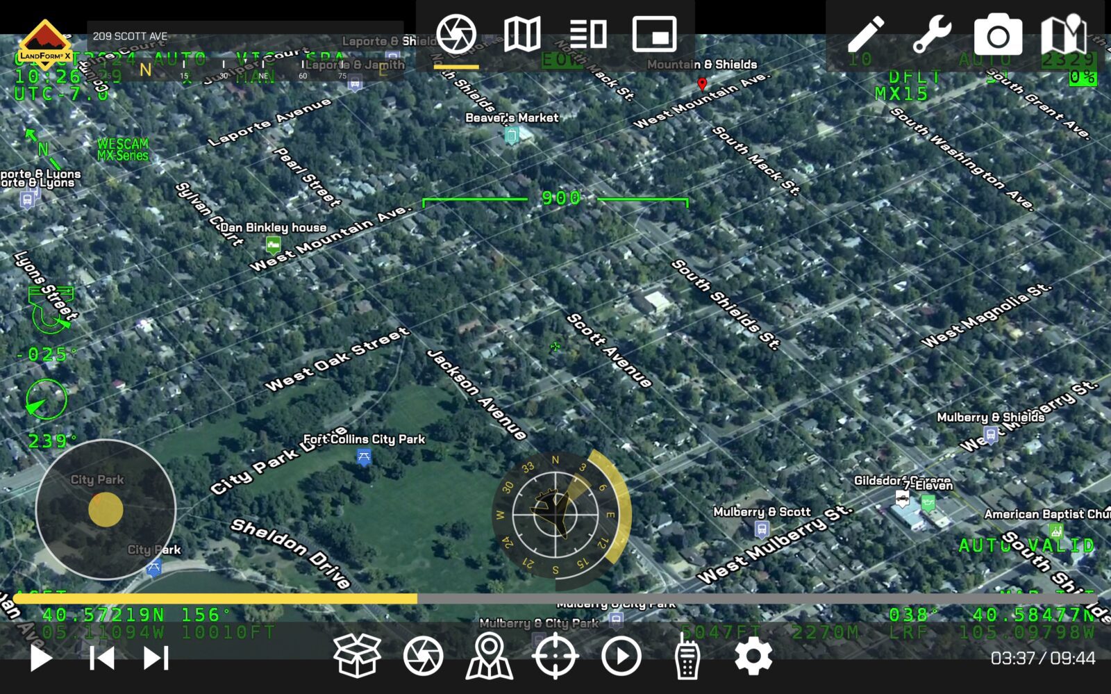
SmartCam3D® allows end-users to overlay nearly any entity with a geographic context onto real-time, full-motion-video (e.g., Road Vectors, Street Names, POIs, Custom GIS data, vectors, polygons, 3D objects, etc.).
Custom GIS Importing
SmartCam3D® allows users to import custom GIS data (e.g., .kmz) and display custom entities in the FMV.
FMV Geocoding
SmartCam3D® provides three geocoding options to forward- or reverse-geocode locations within live FMV.
Address Autocomplete
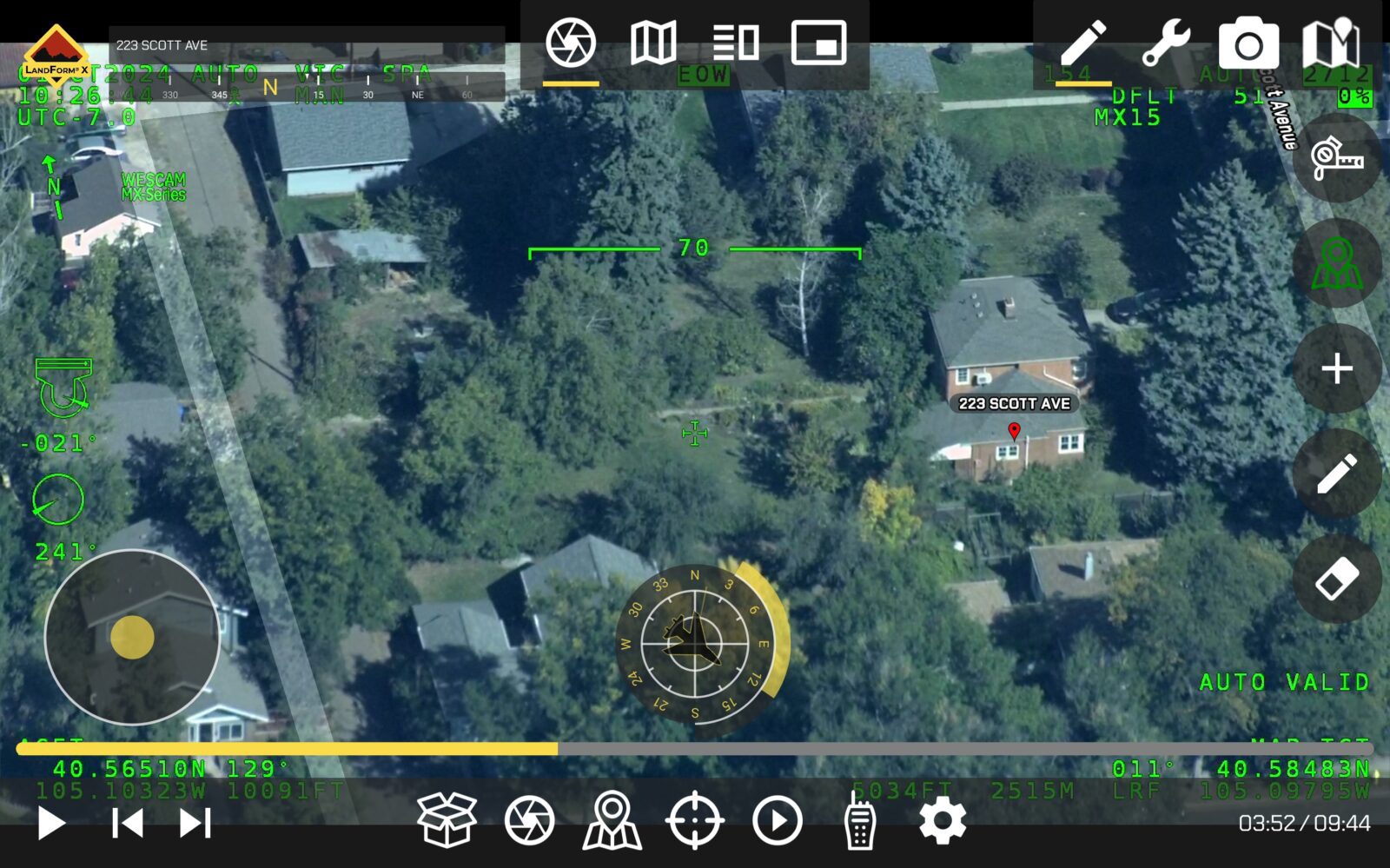
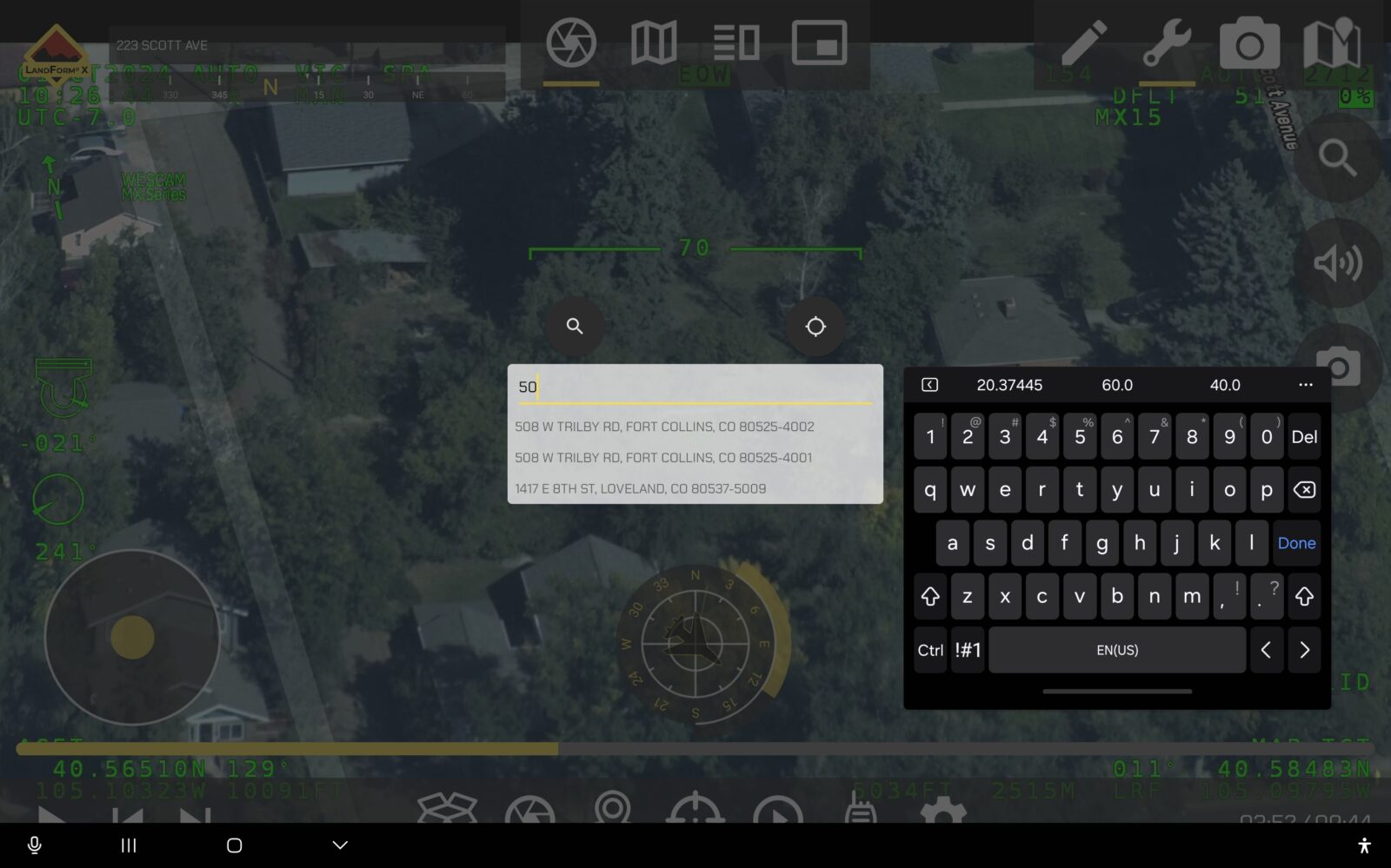
SmartCam3D® includes an intelligent address search, which auto-completes search queries similar to Google Maps.
Cross Cueing
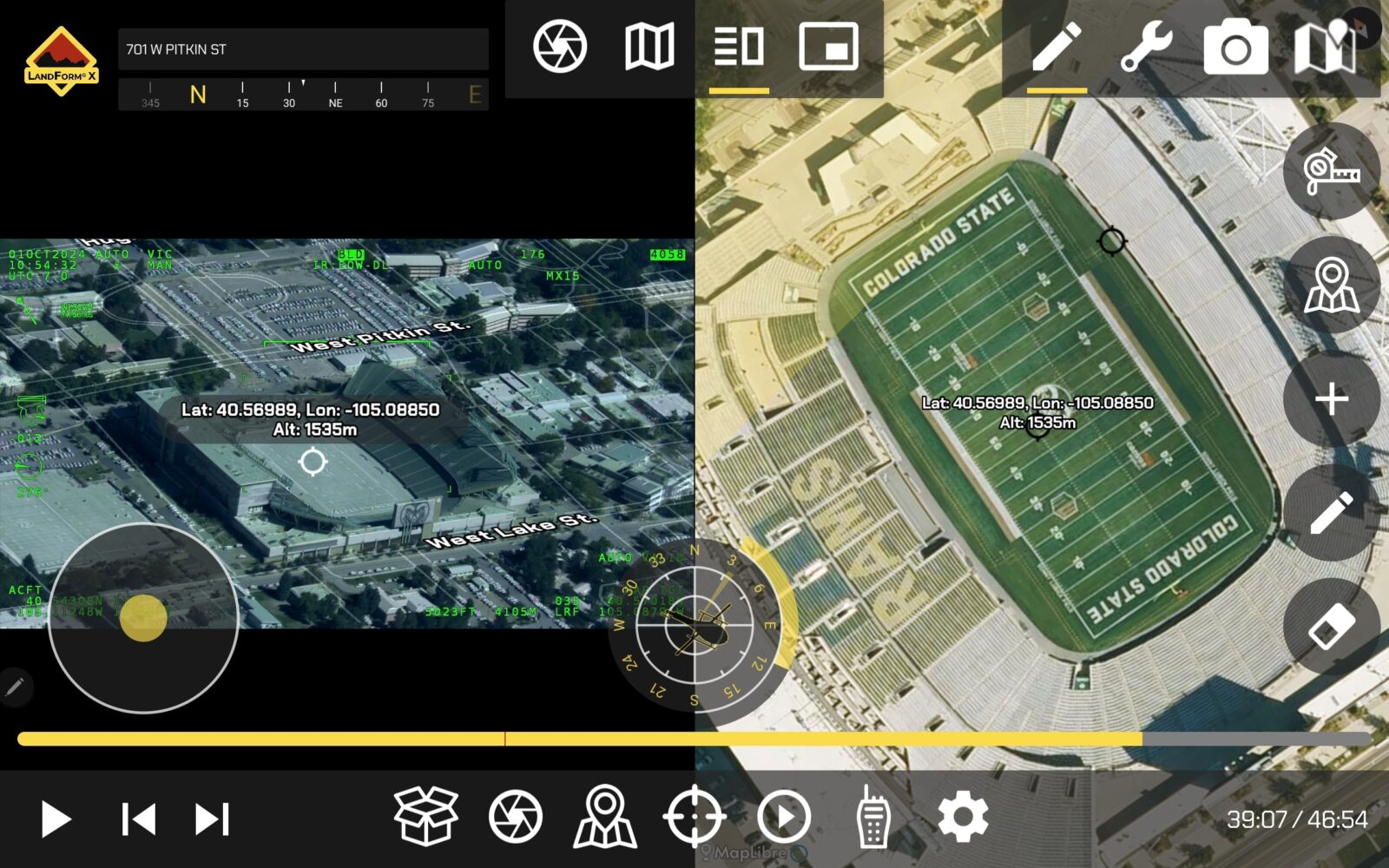
SmartCam3D® allows users to simultaneously navigate the map and FMV displays using an Active and Reactive cursors.
FMV Annotations
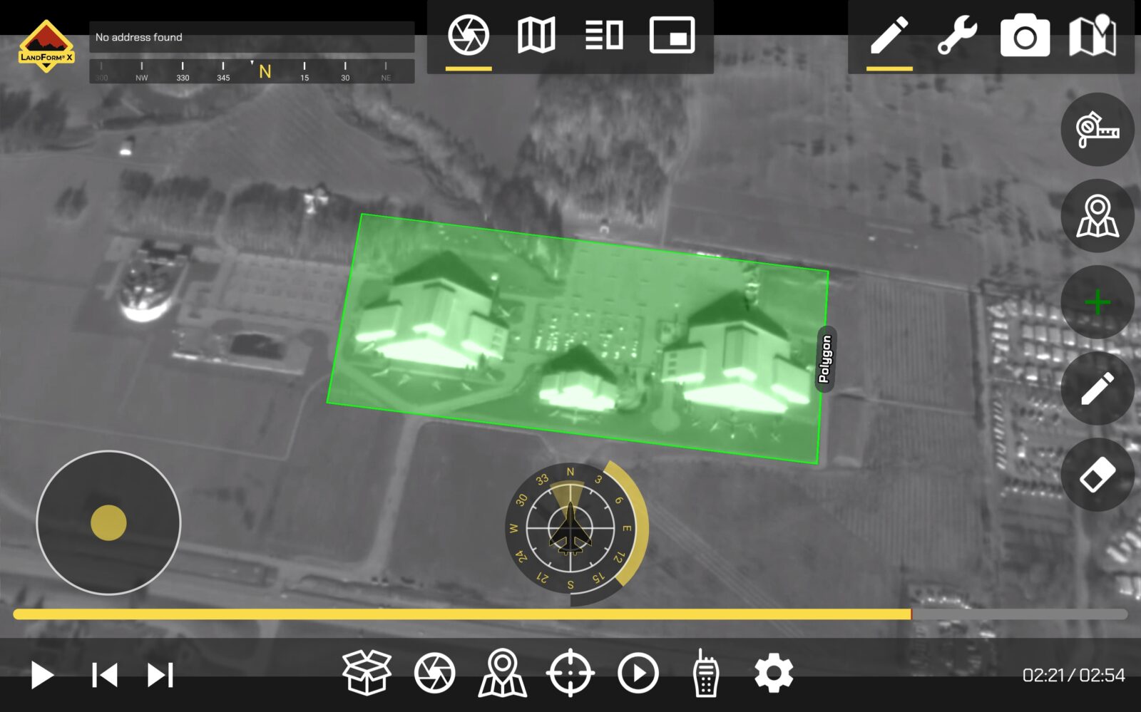
SmartCam3D® allows users to mark targets, draw line vectors, create polygons, insert text, and interact with the FMV as if it were a map display.
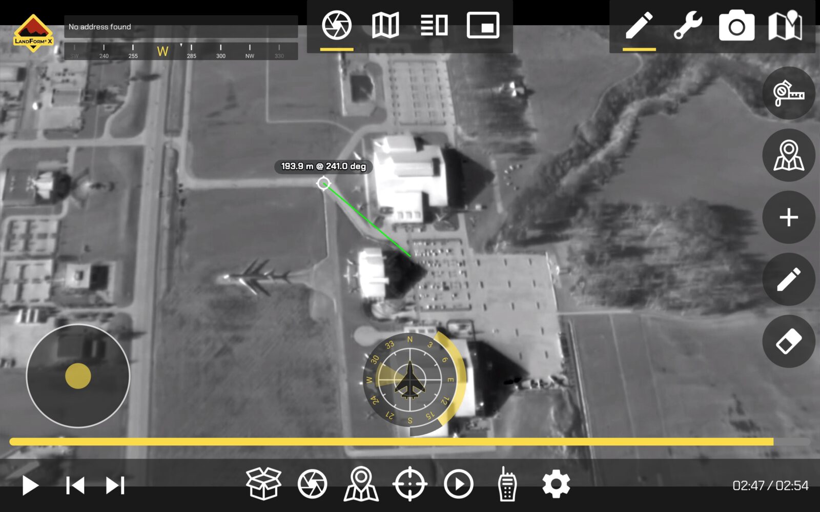
FMV Measurement
SmartCam3D® allows users to measure within live FMV. Range & Bearing tools are provided and users can also measure the areas of closed polygons.
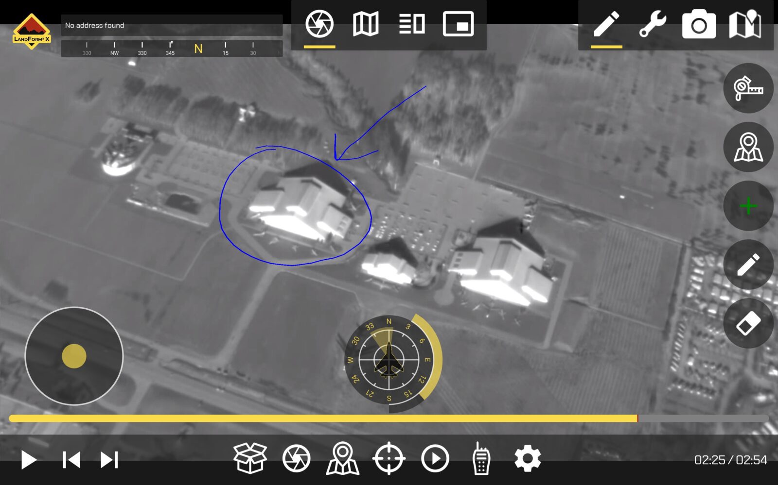
Geospatial Telestrator
SmartCam3D® allows users to free-hand annotate live FMV. Each annotation is logged in the target list and has a geospatial context, meaning it can be shared to separate map displays.
Elevation Query
SmartCam3D® allows users to query the elevation of any ground location within the viewing footprint. It also provides an automated read-out tied to the starepoint of the gimbal.
TAK Server Compatible
SmartCam3D® is compatible with TAK Server. This is becoming increasingly important for airborne law enforcement, Search & Rescue, and wildfire management, as agencies continue to adopt the TAK ecosystem.
3rd Party Applications
SmartCam3D® is a software library compatible with Android, iOS, Linux, Mac, and Windows. It can be licensed and integrated into a wide variety of applications.
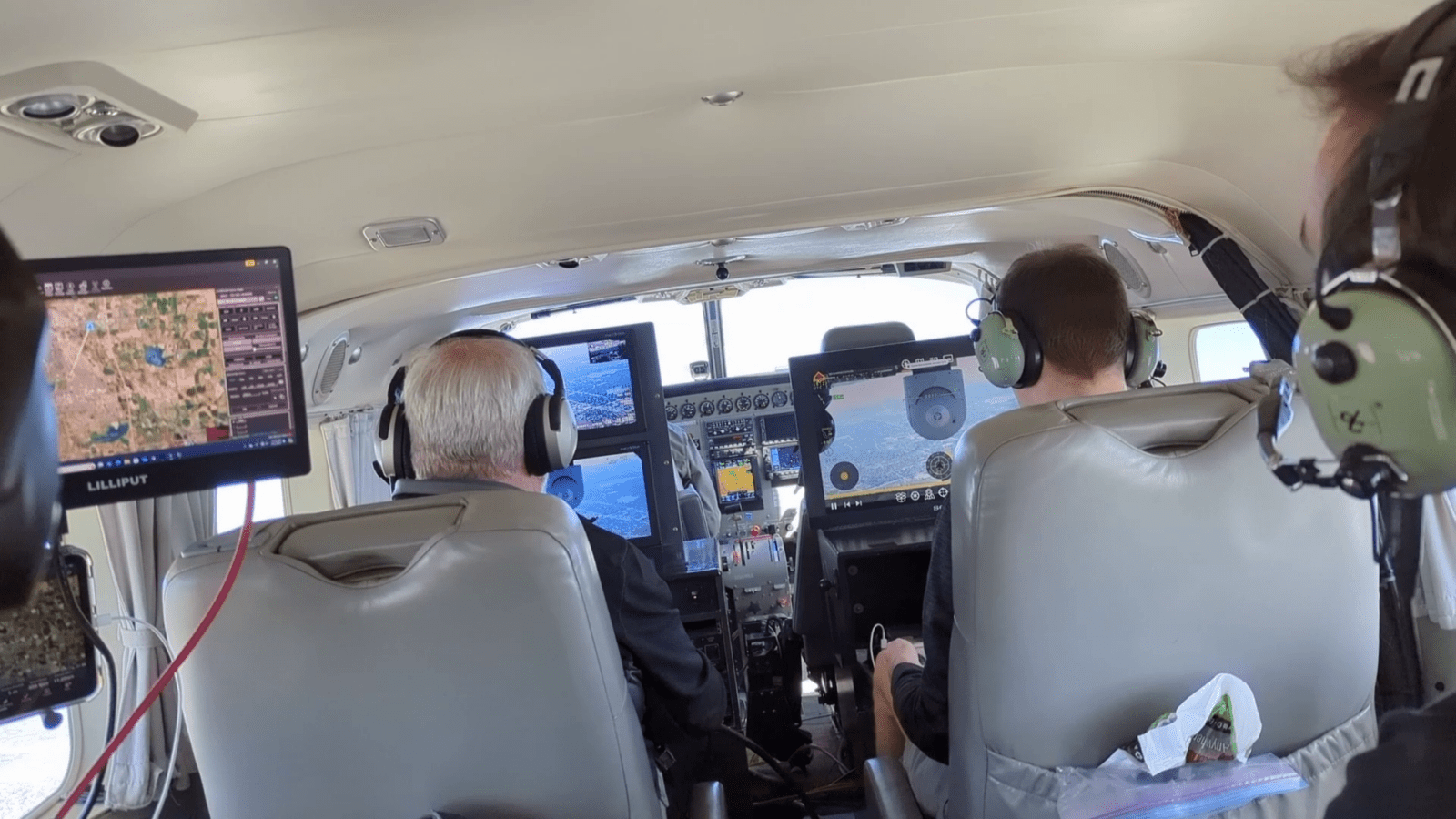
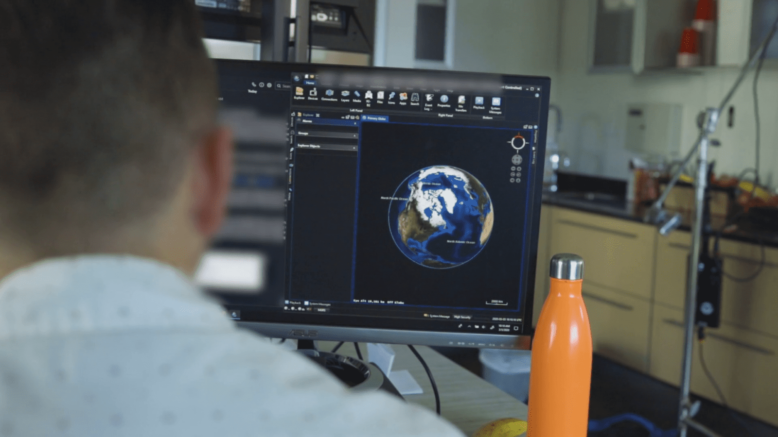
Ground Control Stations
The earliest deployments of SmartCam3D® were in Ground Control Stations for NASA and the US Army. We still maintain GCS deployments for unmanned systems and continue to offer the capability for this use case.
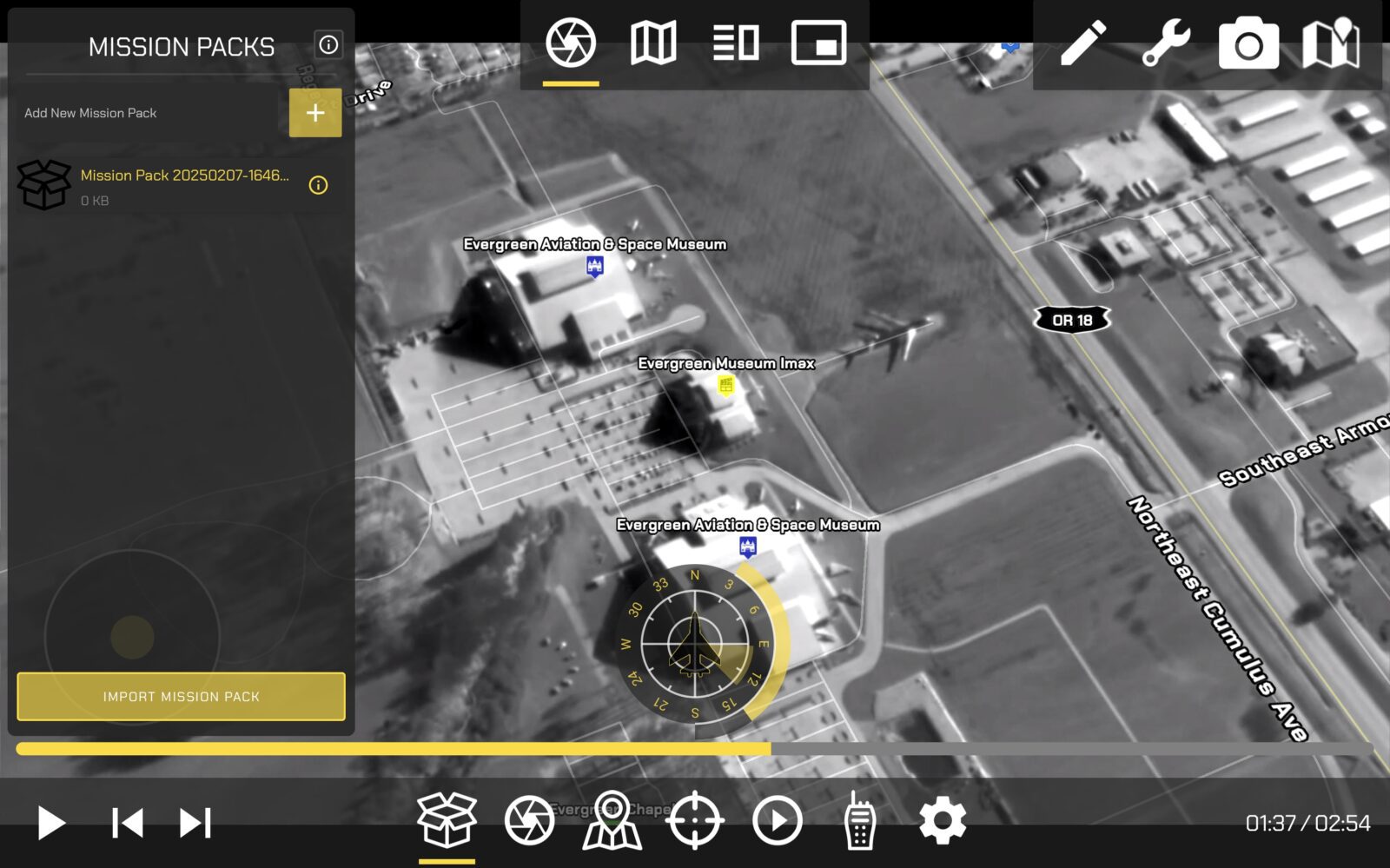
Mission Management Systems
SmartCam3D® is currently embedded within CTI's ISR Mission Management System, LandForm® X. It is also available for licensing to other vendors with their own Mission Management Systems in need of geospatial AR or FMV annotation tools.
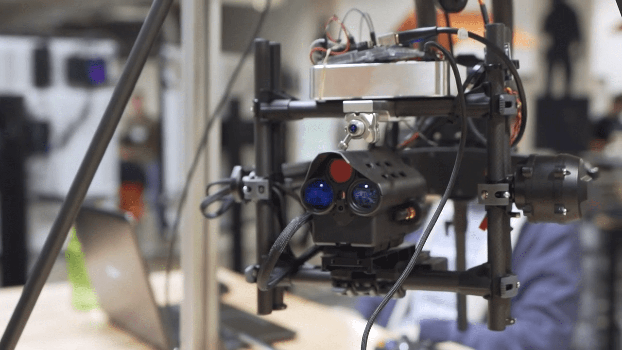
Hardware
SmartCam3D® can be embedded into hardware solutions as well. For this use case we typically run on an embedded chipset, such as the NVIDIA Jetson family of chips. The SmartCam3D® library is fairly light-weight so please contact us if you are interested in compability with your product.
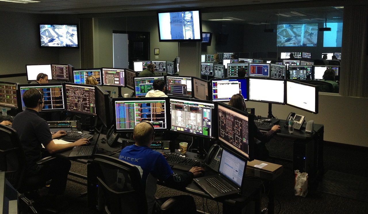
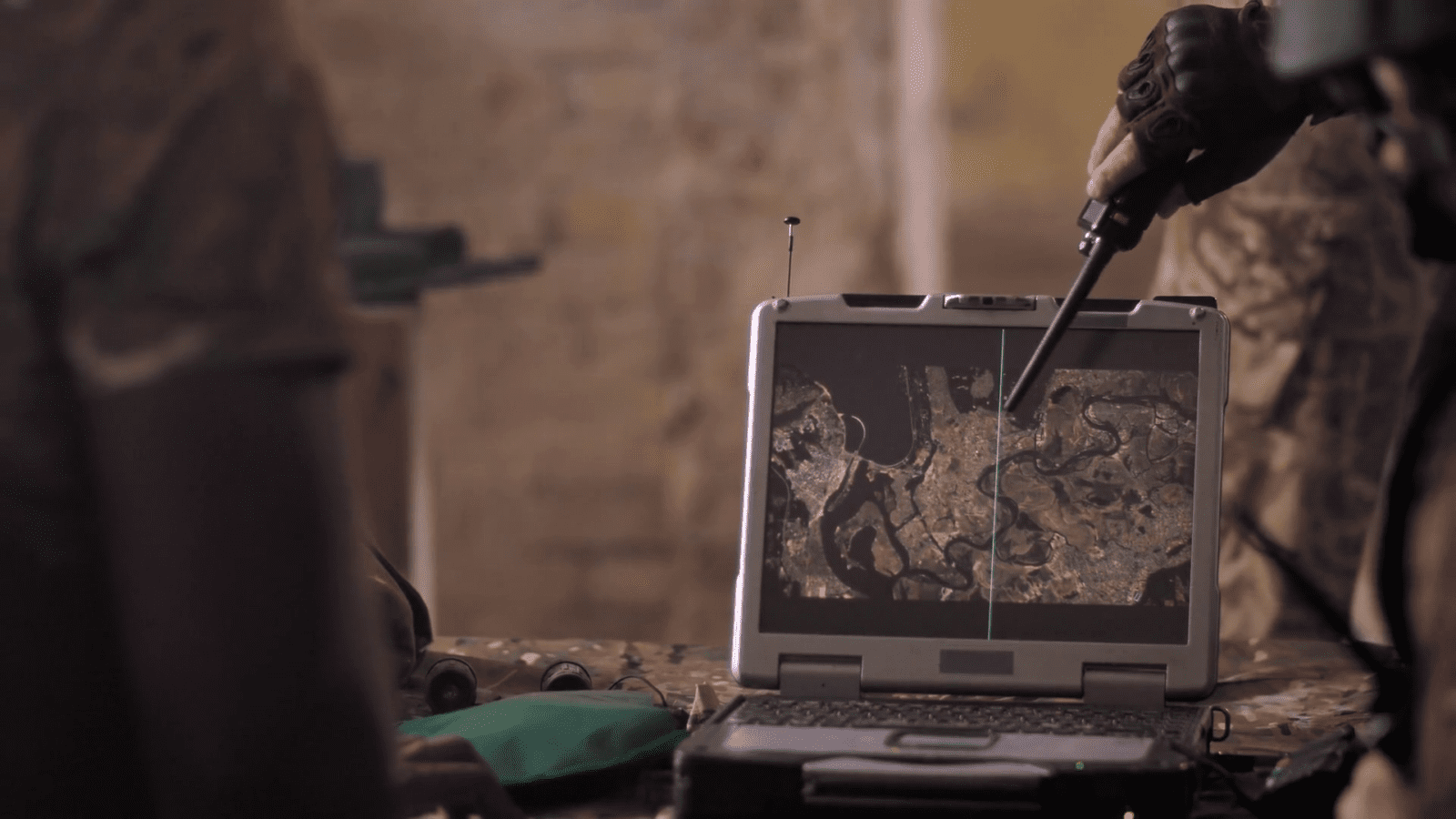
Operations Center
SmartCam3D® can be deployed throughout the FMV ecosystem. One of the most impactful locations to provide the technology is within the Operations Center where commanders can get a macro-view of the scene aided by geospatial augmented reality overlays and FMV annotation tools for coordination.
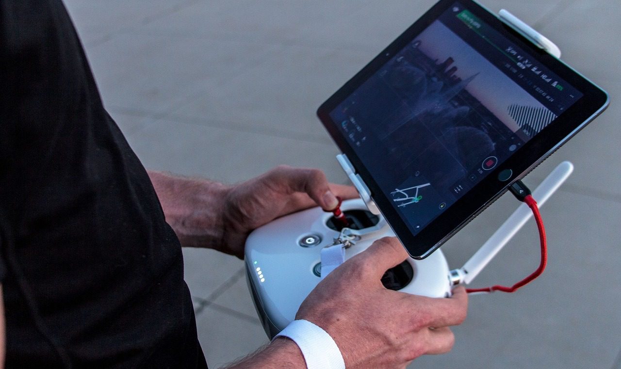
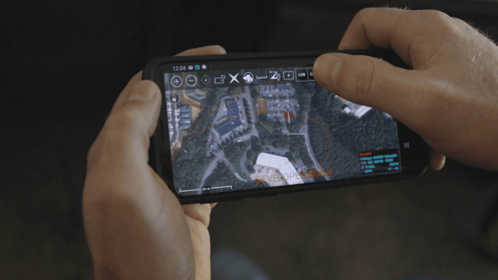
sUAS Pilot Apps
SmartCam3D® has been deployed to sUAS pilot applications to aid pilots in command with geospatial intelligence on their real-time video display. By overlay geographic information like road vectors, street names, and points of interest, end-users can quickly understand their environment and more effectively communicate with their colleagues.
TAK Plugins
SmartCam3D® is integrated with the TAK ecosystem. Presently, there are SmartCam3D® plugins for ATAK, TAKX, and WinTAK. These plugins provide geospatial augmented reality overlays on real-time FMV sourced from airborne ISR assets and allow end-users to interact with the FMV as if it were the TAK Map using the all the core TAK tools (e.g., Pin Dropper, R&B, Drawing, Radial Menu, etc.).
Web-Based Video Players
SmartCam3D® is compatible with web-based video players. This allows for many different applications ranging from broadcast news and entertainment to Drone-As-A-First-Responder (DFR) applications. By being web-capable, SmartCam3D® provides geospatial AR and FMV annotation tools to remote viewers leveraging the capability on the web.
Digital Overwatch
Real-Time Force Protection
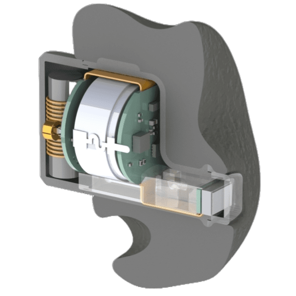
Ear Melds
Precision Audio & Health Monitoring Wearable
Foundation
Composable, Containerized Environment for Data Collection, Exploration, and Integration
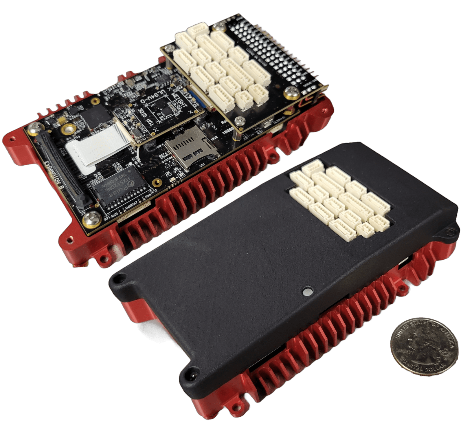
IronClad
NDAA-Compliant, Cybersecure, UxS Controller and Compute Module
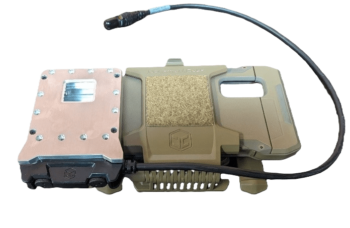
LandForm® X
Carry-On ISR Mission Management System
Merlin
Spectrum Battlespace Mod & Sim Software for Multi-Domain Operations
SmartCam3D®
Geospatial Augmented Reality, Analytics, and Annotation Tools for Real-Time FMV

TAKaaS
TAK-as-a-Service
TAKX
Cross-Platform Situational Awareness COP and MMS
WAVE
LPI/LPD, High-Bandwidth Communications for Vehicles

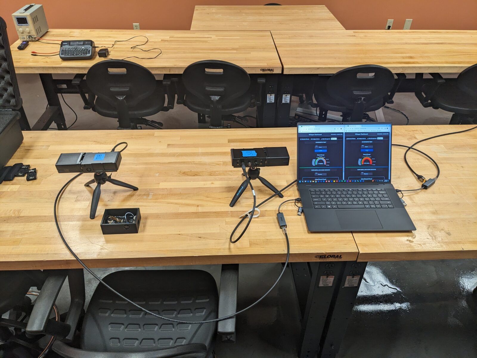
Whisper
LPI/LPD, High-Bandwidth Communications